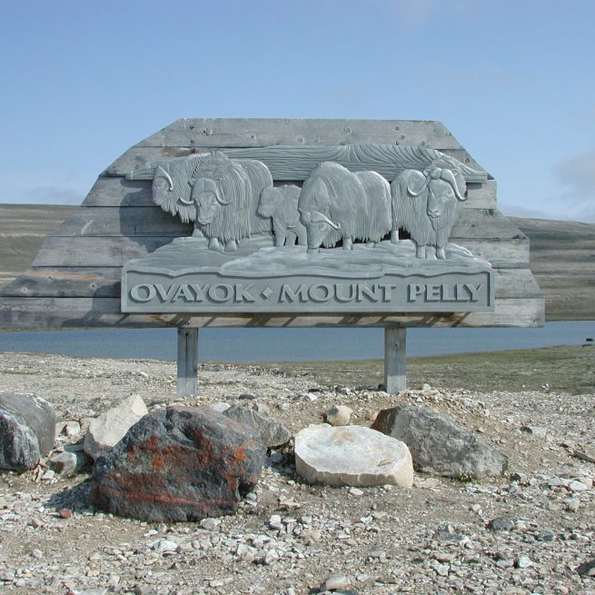
Ovayok Territorial Park
About
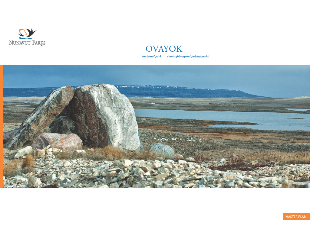
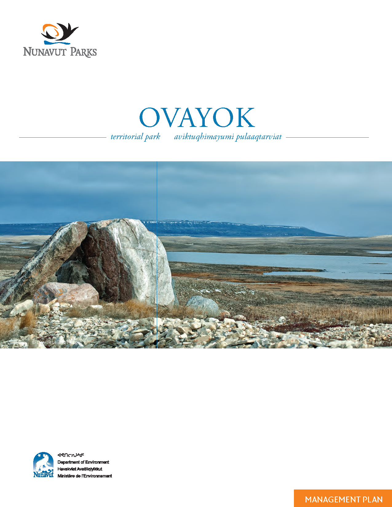
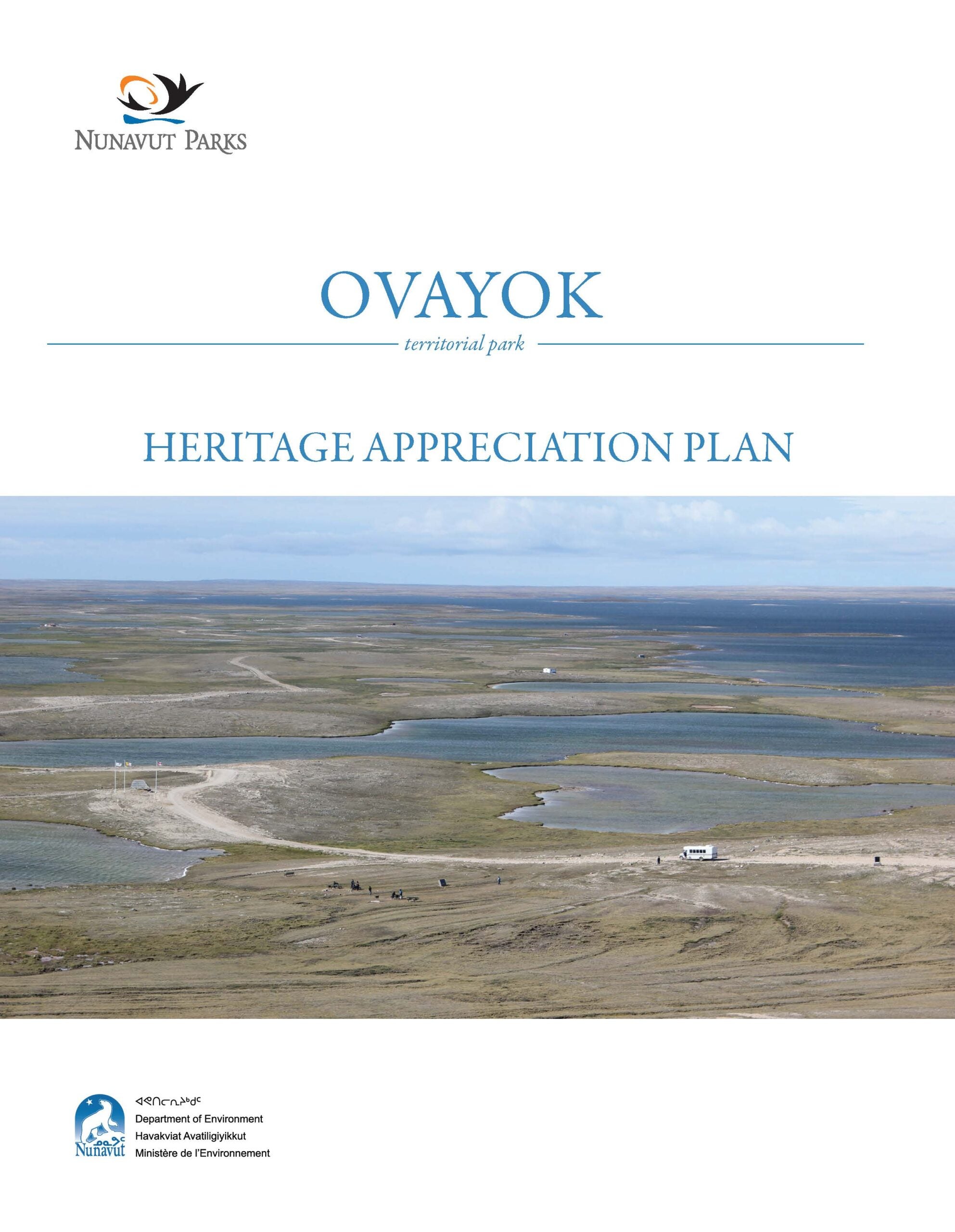
Ovayok Territorial Park is located 16 kilometres east of Cambridge Bay on Victoria Island.
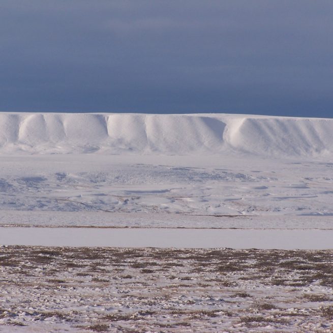
The park is defined by three tall mountains. One of these is Ovayok Mountain, which is 200 metres high.
One of the legends of the park includes the story of three giants named Ovayok, Inuuhuktuq, and Amatok. A long time ago, when people lived forever, there was a family of giants who lived on the north side of Victoria Island. They were people of the sea and preferred to eat large sea mammals. One summer when food became scarce, the hungry giants decided to walk south across the island. They were led by the father, Ovayok. The giants became hungrier as they wandered south because they could not find any suitable food. The caribou looked so small to them that they never thought to eat them.
Eventually, Amatok, the mother of the family, collapsed from hunger. Ovayok and his son, Inuuhuktuq, tried to continue their journey, but Inuuhuktuq collapsed while Ovayok struggled on. Finally Ovayok collapsed, falling face down on the ground. They all died where they lay and became the three mountains found on Victoria Island: Ovayok Mountain, Inuuhuktuq Mountain, and Amatok Mountain.
Ovayok Territorial Park was used by Copper Inuit or Ki’linirmeot as an area for fishing, and for hunting migrating birds. Inuit usually spent time in and around the park in the spring and fall.
They moved inland in the summer to hunt caribou.
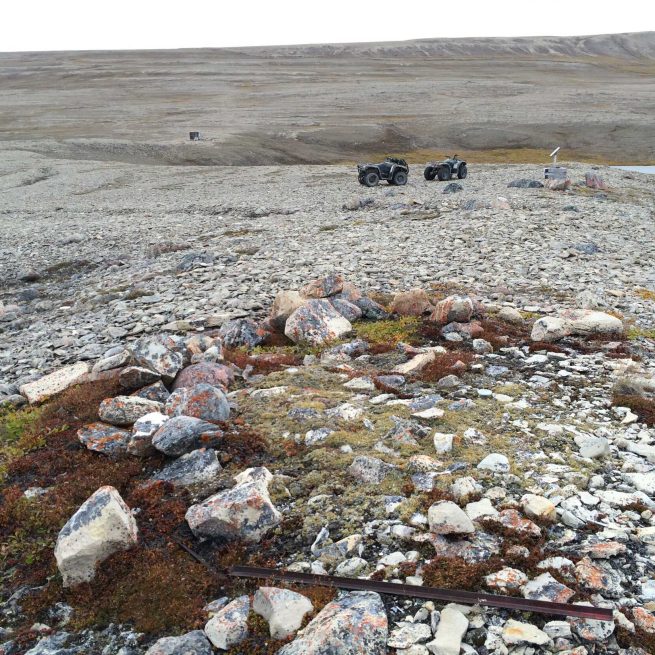
You may see stone caches left behind by the Copper Inuit that were built within the park to store winter clothing and hunting gear in warmer months.
Natural Heritage
Plants you can find on the tundra in Ovayok Territorial Park include purple saxifrage, Arctic poppies, and mountain avens. On the mountain slopes, you can find Arctic white heather, large-flowered lousewort, and mountain sorrel. There are wetlands in the park where you can find Arctic cotton or purple bladder campion.
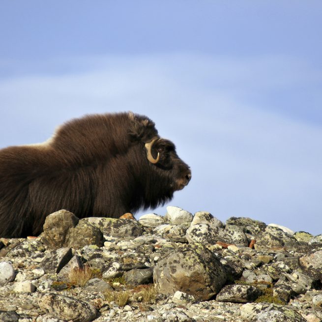
The wildlife in Ovayok Territorial Park is one of the prime attractions for visitors. You may see a muskox from a herd that stays near the park year-round. You might even see the qiviut, the undercoat of muskoxen, on the ground in the summer. When it is woven, qiviut can be used to make very warm hats and mittens. It can also be put inside your gloves in the winter to keep your hands warm.
It is possible to see “island” caribou that migrate to the mainland of Nunavut over the ice in the winter. Other mammals you might see in the park include lemmings, voles, Arctic hares, and Arctic foxes.
If you are lucky, you may see beautifully coloured birds like yellow-billed loons and king eider ducks. You may also notice shorebirds like red phalaropes, red knots, and black-bellied plovers nesting near ponds or on gravel slopes. There are over 50 species of migratory birds in the park.
Ovayok Territorial Park is a nesting and feeding place for many types of birds.
Recreational Heritage
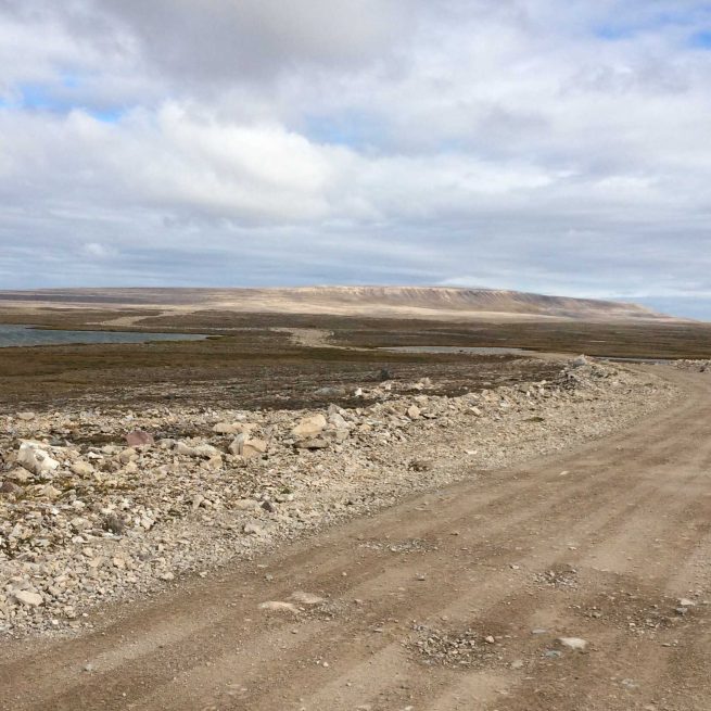
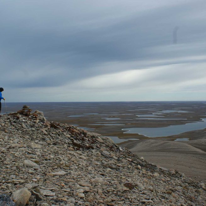
Ovayok Territorial Park is a great place to hike! You can drive to the park on a gravel road from Cambridge Bay. Or, you can hike there in about four to six hours.
There are five different hiking trails in the park. These trails will take you past former campsites with stone tent rings and taluit, or waiting places, where Inuit waited for the caribou to return.
You can hike on the Tulimaq trail past muskoxen, along the slopes of mountains, and past small lakes. The Ovayok trail goes up the slope of Ovayok Mountain to the summit. The Ovayok trail leads to gorges that are referred to as “giant’s ribs” because the side-by-side ridges of mountains look like the ribs of a giant.
Tips
Nunavut’s parks and special places offer unforgettable experiences; but travel to any remote area can involve risk. Visitors are urged to familiarize themselves with these risks before their trip, and to prepare themselves accordingly. The arctic environment is vulnerable to human disturbance and recovers very slowly. Minimize your impact on park environments, follow park regulations, and try to leave no trace.
Travel within Nunavut’s Territorial Parks offers some of the most breathtaking scenery and magnificent wildlife imaginable, but also involves the risks associate with travelling in any remote area. Travellers are urged to take responsibility for their own safety. Careful preparation and research to learn about local landscapes, weather, wildlife, and potential hazards is advised. Physical conditions within parks, in the water and on trails can change rapidly; weather conditions can shift; and encounters with wildlife are frequent.
The World Commission on Environment and Development defines “sustainable” travel as “meeting the needs of the present without compromising the ability of future generations to meet their own needs.” The World Tourism Organization specifies that sustainable travel is the “management of all resources in such a way that economic, social, and aesthetic needs can be fulfilled while maintaining cultural integrity, essential ecological processes, biological diversity, and life support systems.”
Vital, timely information assistance for safe and sustainable travel in our parks is available through regulations and information posted in our parks; on Government of Nunavut websites and other resources in our park communities; from local guides, hunters and other community residents; and from a wide variety of other print and online resources. Visitors are urged to consult these sources in order to guarantee themselves a safe and memorable experience, and to protect Nunavut’s unique natural and cultural legacy.
.The arctic environment is vulnerable to human disturbance and recovers very slowly. Minimize your impact on park environments. Visitors are required to follow park regulations and encouraged to leave no trace.
Enjoy the park and respect the land. Reduce your impact by following park rules:
- Inuit rights to harvest, fish and camp in the park are protected by law. Do not interfere with Inuit traditional uses of the park.
All-terrain vehicles damage the land. Drive only on designated trails and use the parking areas in the park. - Fishing licenses are required for non-Inuit. Purchase your license at the Wildlife Conservation Office, the Department of Environment or Fisheries and Oceans Canada, most sport fishing lodges, sporting goods, hardware and convenience stores, or at certain offices of the Royal Canadian Mounted Police.
- Respect wildlife and the environment. Do not approach wildlife for any reason. Leave rocks, plants, and other natural objects as you find them.
You are in bear country. Be prepared for bear encounters. Stay alert, travel in groups and with a guide. Keep your campsite and picnic area clean at all times. Report bear sightings to the local Wildlife Conservation Office and Nunavut Parks staff.
Camp a reasonable distance away from day-use areas to allow other park visitors access to these facilities. - Respect other park users. Keep noise to a minimum.
- Keep pets on leash and pick up all pet waste.
- Dispose of garbage in bins or take it out with you.
- Use the outhouses in the park, or in parks with no outhouses, bury human waste.
- Archaeological sites are protected by law. Please don’t touch archeological sites or artefacts. Report archaeological finds to the Territorial Park office.
Nunavut is bear country. To ensure your visit is safe and enjoyable, stay alert to your surroundings, prepare for an encounter and report bear sightings or incidents to the local Wildlife Conservation Office and Nunavut Parks staff.
Bears can be encountered in Nunavut parks. Polar bears may be encountered in any location but are most common in coastal regions. Barren ground Grizzly bears may be encountered in mainland Nunavut. If you intend to travel in Nunavut parks you can reduce your risk of a bear encounter with a few precautions:
- Educate yourself about the area you plan to hike in.
- Hire a local guide with knowledge of how to handle a bear situation.
- Pre-plan, rehearse and know what to do for different bear encounter scenarios.
- Know where bears can be found at different times of the year. Avoid those areas or be especially cautious when traveling through them.
- Be alert and aware of your surroundings. In open terrain, use binoculars to look ahead for bears. If you notice a bear at a distance, take action to avoid surprising it.
- Travel in daylight and avoid areas of restricted visibility.
- Watch for bear signs such as tracks, droppings, daybeds, dens or seal carcasses.
- Never approach a fresh kill. A bear may be nearby.
- Carry food in airtight or bear-proof containers and avoid carrying foods or articles with strong smells. Take all garbage to camp and dispose of it properly. A trail of litter may lead a bear to you or your camp.
- Consider bear deterrents such as noisemakers or pepper spray.
- Report bear sightings or incidents to the local Wildlife Conservation Office and Nunavut Parks staff.
Nunavut Parks published “Polar Bear Safety in Nunavut Territorial Parks”, in March 2007 and produced the video “Polar Bears: A Guide to Safety”, a 27-minute video produced in partnership with Parks Canada. The video contains important information on how people can reduce their chance of encountering a polar bear, and how to best respond if they do meet a bear.
.Inuit rights to enjoy parks and engage in traditional activities are protected by Nunavut Agreement (NA) and the Umbrella Inuit Impact Benefits Agreement for Territorial Parks in the Nunavut Settlement Region (IIBA). The NA and IIBA protect the rights of Inuit to access territorial parks for harvesting. Park visitors are required to respect these rights, and to take appropriate steps to avoid interfering or disturbing Inuit traditional activities.
Inuit rights within a Territorial Park are protected by the Nunavut Agreement (NA) and the Umbrella Inuit Impact Benefits Agreement for Territorial Parks in the Nunavut Settlement Region (IIBA). The NA and IIBA protect the rights of Inuit to continued land use for harvesting, outpost camps, carving stone, access, and other purposes in territorial parks.
Inuit harvesting activities (hunting, fishing and gathering) are allowed in established territorial parks, and will continue to be allowed in areas where a new territorial park may be established in the future.
The NA and IIBA both require that Inuit and the GN jointly plan and manage the lands, waters, and resources within parks. Joint planning and management is the process by which government, Inuit and communities work together to make and implement decisions. The IIBA formalizes joint planning and management by setting out principles and objectives to ensure meaningful Inuit participation in park planning and management decision-making, at both the territorial and community levels. A Nunavut Joint Planning and Management Committee (NJPMC) advises on Nunavut-wide parks initiatives (IIBA Article 13.1.1 d), and Community Joint Planning and Management Committees (CJPMC), working at the community level, plan and manage parks in or near each affected community (IIBA Article 13.1.1 d).
The planning and management process followed by Nunavut Parks will ensure that Inuit Qaujimajatuqangit (IQ) substantially informs the decision-making process, and that visitor uses of a park, and park programs or development, do not conflict with Inuit use and enjoyment of territorial parks.
.All archaeological sites in Nunavut are protected under the Nunavut Archaeological and Paleontological Sites Regulations, which prohibit unauthorized disturbance. Do not move or remove stones, bones, or artifacts, and report new archaeological finds to the Government of Nunavut.
The protection of Nunavut’s archaeological and paleontological heritage is an important priority of the Government of Nunavut (GN), and a responsibility shared with the Government of Canada. Under the Nunavut Act, regulations for the protection, care and preservation of archaeological and paleontological sites are regulated under the authority of the GN Minister for Culture and Heritage (C&H); and study, access, documenting and investigating archaeological and/or paleontological sites and databases require research permits. The GN Department of C&H requires a Nunavut Archaeological Sites Database license to view previously recorded data; and Archaeology and Palaeontology Permits (Class 1 or Class 2) for research projects and inventory fieldwork.
Class 1 permits authorize only the documentation of an archaeological and/or paleontological site, including preparing a site map, recording the site’s geographic location, and the number, type and distribution of features present. Class 1 permits do not allow for the collection of artifacts.
Class 2 permit authorizes the documentation of an archaeological and/or paleontological site along with the excavation and removal of artifacts and/or specimens. These permits are only issued to professionally qualified archaeologists and/or palaeontologists.
Additional information can be found in the C&H department’s Guidelines for Applicants and Holders of Nunavut Territory Archaeology and Palaeontology Permits.
The Department of C&H also administers the Human Remains Policy to ensure that any archaeological investigation or analysis of human remains or associated grave goods will be conducted in a manner that is sensitive to Nunavummiut values, ethical and scientific principles, and which complies with all applicable laws, codes of conduct, and conventions.
If archaeological and/or paleontological sites or artefacts are found in a territorial park, the regulations are not to touch, do not move or remove stones, bones, or artifacts, and immediately report finds to the GN.
The process for all artifact discoveries is quite straightforward; finds have to be reported to the Territorial Archaeology Office, including as much details as possible, for example:
- Name of the person(s) who found the artifacts
- Date of the find
- Location of the find (GPS coordinates) if available
- Photographs if available
- Any other relevant information
The C&H Department will then address the issue and provide recommendations/action.
The Inuit Heritage Trust has three general information booklets on archaeology in Nunavut that are available online (http://www.ihti.ca/eng/iht-proj-guide-booklets.html):
- Booklet for Northern Communities;
- Booklet for Northern Heritage Workers;
- Booklet for Northern Students.
Parks offer a deep emotional connection to the land. They are places that say “katjaqnaaq” – I am content in this beautiful and special place, I have found peace, I am home.
To understand our parks, we must experience them. We must listen to the land.
Nunavut, “our land”, is defined by its people and places. It is an arctic territory that evokes images of vast space and endless skies, wide tundra plains, ice-capped mountains, lands and seas teeming with wildlife, and rich cultural traditions still practiced today.
“Katjaqnaaq”, as much a feeling as an expression, reveals a depth of emotion and connection to a place of incredible beauty and significance. Uttered as a sigh, it can mean “ah – I am happy here, I am part of something.” As a joyful exclamation, it can mean “oh, what a beautiful place!” However it is used, it evokes connectedness to one’s surroundings and a sense of peace and meaning.
The Parks & Special Places division of the Government of Nunavut is working with Nunavummiut to identify and protect these significant areas as territorial parks and special places, understanding that they mean many things to many people: they are places of escape, places for reflection, places of power, and places that celebrate our cultural and natural heritage.
In the North, the idea of a park or special place is different. It is linked more to utility and being on the land than beauty and aesthetics, which are appreciated in a different way. In Nunavut, special places are prime hunting or fishing spots, good camping sites, places where groups of people gathered in the past, or places of mystical significance.
.Did you know?
Snowy owls nest on small hills. You might see them in Ovayok Territorial Park as they hunt voles and lemmings to feed their young.
Did you know?
Snowy owls nest on small hills. You might see them in Ovayok Territorial Park as they hunt voles and lemmings to feed their young.
Community Joint, Planning and Management Committee
- Junna Ehaloak
- Jaida Ohokannoak
- Clara Wingnek
- Talia Maksagak
- Bob Aknavigak
- Kitty Taipagak
- Annie Neglak
Community Joint, Planning and Management Committee
- Junna Ehaloak
- Jaida Ohokannoak
- Clara Wingnek
- Talia Maksagak
- Bob Aknavigak
- Kitty Taipagak
- Annie Neglak

Park Specific Contact
P.O. Box 377
Kugluktuk, NU
X0B 0E0